State Nature Conservancy of the Slovak Republic
Slovak Caves Administration


Geographic information system of caves consists of various components. Firstly it is depiction of underground cave spaces. The primary sources are in paper form that are scanned to the digital one. These are georeferenced on demand and vectorized with the result of a vector map of underground spaces. This map can be used for various purposes.
The selected caves are depicted in three-dimensional space. The model is created by connection of measured characteristic profiles. Some of the show caves have measured all the technical facilities underground – path, handrails, lights etc.
Except for underground spaces illustration, it is necessary to know the projection of these spaces on the surface. Since the underground spaces are georeferenced, this task can be easily fulfilled by simultaneous opening of selected map layers.
Geographic information system helps us when designing proposals for cave protection zones. We use here linkages from the graphics to plot database and calculations of area of the protection zone with plots lying inside.
Within the documentation funds we process digital archives for photographs, library and maps.
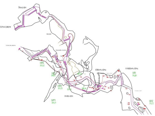 Geographic information system of caves – vector map of underground spaces
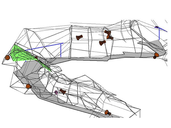 Demonstration of three-dimensional cave model
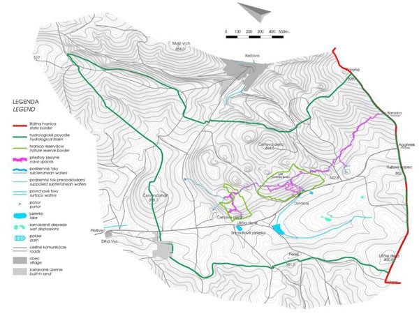 Projection of cave spaces on the surface
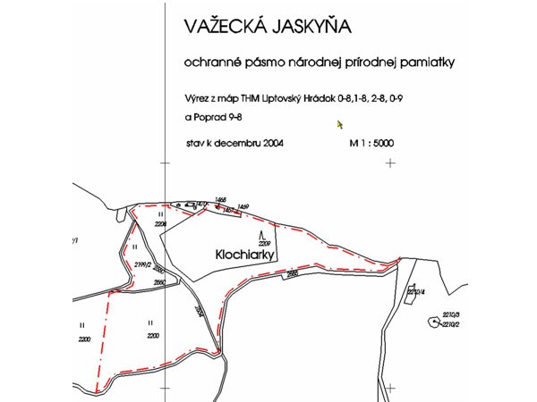 Linking graphics with plot database
 Digital photo-archive, library and map archive
Dear visitors,
We appreciate your interest in our show caves and since we want you to feel comfortable during your visit and to perceive the beauty of underground nature more intensely, we have canceled fees for photography/filming as part of a regular tour from January 1, 2026. However, this does not mean an extension of the tour time and we ask you to follow the instructions of our guides. We wish you a pleasant experience!
Dear visitors, visiting the cave requires adequate physical fitness.
The route includes:
- a longer walk in an enclosed darkened area
- reduced temperature and increased humidity
- ascent and descent
- higher number of steps (in some caves)
Special note to persons with medical limitations:
If you suffer particularly from cardiovascular disease, respiratory problems, high blood pressure, mobility limitations or are in poor physical condition, please consider taking part in the tour.
If you have any doubts about the appropriateness of your visit, please consult your doctor about your medical condition.
Your safety is of paramount importance to us.
Thank you for your understanding
Slovak Caves Administration, State Nature Conservation of the Slovak Republic
Dear visitors, we would like to inform you that due to the technical conditions of payment terminals, there may be situations when card payment will not be possible. For this reason, we recommend that you have an adequate amount of cash available if you want to be sure that you will be able to visit the cave. Thank you for understanding.
Dear visitors, due to technical reasons at the cave, it is not possible to provide food and drinks, including coffee vending machine services. We apologize for this inconvenience.
Dear visitors, the parking lot doesn't belong to cave administration. The fees are collected by different entity. Thank you for your understanding.
